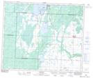
Maps showing Chitek Lake 191, 25,26-54,55-12,13-W3, Saskatchewan
Chitek Lake 191 is a Indian Reserve located in 25,26-54,55-12,13-W3, Saskatchewan.
- Latitude: 53° 42' 57'' North (decimal: 53.7158812)
- Longitude: 107° 45' 3'' West (decimal: -107.7506956)
- Topography Feature Category: Indian Reserve
- Geographical Feature: Indian Reserve - Réserve indienne
- Canadian Province/Territory: Saskatchewan
- Location: 25,26-54,55-12,13-W3
- Atlas of Canada Locator Map: Chitek Lake 191
- GPS Coordinate Locator Map: Chitek Lake 191 Lat/Long
Chitek Lake 191 NTS Map Sheets