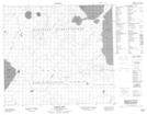
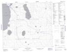
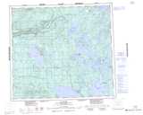
Maps showing Clearwater River Dene Band 221, 84,85-22,23-W3, Saskatchewan
Clearwater River Dene Band 221 is a Indian Reserve located in 84,85-22,23-W3, Saskatchewan.
- Latitude: 56° 20' 31'' North (decimal: 56.3419182)
- Longitude: 109° 32' 42'' West (decimal: -109.5451379)
- Topography Feature Category: Indian Reserve
- Geographical Feature: Indian Reserve - Réserve indienne
- Canadian Province/Territory: Saskatchewan
- Location: 84,85-22,23-W3
- Atlas of Canada Locator Map: Clearwater River Dene Band 221
- GPS Coordinate Locator Map: Clearwater River Dene Band 221 Lat/Long
Clearwater River Dene Band 221 NTS Map Sheets