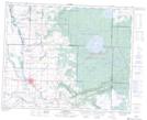
Maps showing Cote 64, 30-31,32-W, Saskatchewan
Cote 64 is a Indian Reserve located in 30-31,32-W, Saskatchewan.
- Latitude: 51° 37' 51'' North (decimal: 51.6306993)
- Longitude: 101° 54' 53'' West (decimal: -101.9148041)
- Topography Feature Category: Indian Reserve
- Geographical Feature: Indian Reserve - Réserve indienne
- Canadian Province/Territory: Saskatchewan
- Location: 30-31,32-W
- Atlas of Canada Locator Map: Cote 64
- GPS Coordinate Locator Map: Cote 64 Lat/Long
Cote 64 NTS Map Sheets