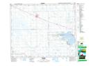
Maps showing Fishing Lake 89A, 13-33-11,12-W2, Saskatchewan
Fishing Lake 89A is a Indian Reserve located in 13-33-11,12-W2, Saskatchewan.
- Latitude: 51° 49' 48'' North (decimal: 51.8300977)
- Longitude: 103° 34' 48'' West (decimal: -103.5798855)
- Topography Feature Category: Indian Reserve
- Geographical Feature: Indian Reserve - Réserve indienne
- Canadian Province/Territory: Saskatchewan
- Location: 13-33-11,12-W2
- Atlas of Canada Locator Map: Fishing Lake 89A
- GPS Coordinate Locator Map: Fishing Lake 89A Lat/Long