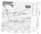
Maps showing Fond du Lac 231, 116, 117- 11,12-W3, Saskatchewan
Fond du Lac 231 is a Indian Reserve located in 116, 117- 11,12-W3, Saskatchewan.
- Latitude: 59° 7' 20'' North (decimal: 59.1222501)
- Longitude: 107° 54' 9'' West (decimal: -107.9025664)
- Topography Feature Category: Indian Reserve
- Geographical Feature: Indian Reserve - Réserve indienne
- Canadian Province/Territory: Saskatchewan
- Location: 116, 117- 11,12-W3
- Atlas of Canada Locator Map: Fond du Lac 231
- GPS Coordinate Locator Map: Fond du Lac 231 Lat/Long
Fond du Lac 231 NTS Map Sheets