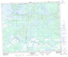
Maps showing Gladue Lake 105B, 17-63-15-W3, Saskatchewan
Gladue Lake 105B is a Indian Reserve located in 17-63-15-W3, Saskatchewan.
- Latitude: 54° 27' 0'' North (decimal: 54.4500238)
- Longitude: 108° 14' 49'' West (decimal: -108.2469236)
- Topography Feature Category: Indian Reserve
- Geographical Feature: Indian Reserve - Réserve indienne
- Canadian Province/Territory: Saskatchewan
- Location: 17-63-15-W3
- Atlas of Canada Locator Map: Gladue Lake 105B
- GPS Coordinate Locator Map: Gladue Lake 105B Lat/Long
Gladue Lake 105B NTS Map Sheets