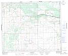
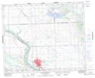
Maps showing LittlePine 116, 45,46-21,22-W3, Saskatchewan
LittlePine 116 is a Indian Reserve located in 45,46-21,22-W3, Saskatchewan.
- Latitude: 52° 47' 19'' North (decimal: 52.7886228)
- Longitude: 108° 9' 17'' West (decimal: -108.1548349)
- Topography Feature Category: Indian Reserve
- Geographical Feature: Indian Reserve - Réserve indienne
- Canadian Province/Territory: Saskatchewan
- Location: 45,46-21,22-W3
- Atlas of Canada Locator Map: LittlePine 116
- GPS Coordinate Locator Map: LittlePine 116 Lat/Long
LittlePine 116 NTS Map Sheets