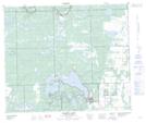
Maps showing Makwa Lake 129A, 20,28-58-21-W3, Saskatchewan
Makwa Lake 129A is a Indian Reserve located in 20,28-58-21-W3, Saskatchewan.
- Latitude: 54° 2' 6'' North (decimal: 54.0351109)
- Longitude: 109° 4' 46'' West (decimal: -109.0794068)
- Topography Feature Category: Indian Reserve
- Geographical Feature: Indian Reserve - Réserve indienne
- Canadian Province/Territory: Saskatchewan
- Location: 20,28-58-21-W3
- Atlas of Canada Locator Map: Makwa Lake 129A
- GPS Coordinate Locator Map: Makwa Lake 129A Lat/Long
Makwa Lake 129A NTS Map Sheets