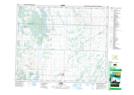
Maps showing Mistawasis 103, 15,16,21,22-48,49-5,6-W3, Saskatchewan
Mistawasis 103 is a Indian Reserve located in 15,16,21,22-48,49-5,6-W3, Saskatchewan.
- Latitude: 53° 9' 46'' North (decimal: 53.1628312)
- Longitude: 106° 48' 10'' West (decimal: -106.8026417)
- Topography Feature Category: Indian Reserve
- Geographical Feature: Indian Reserve - Réserve indienne
- Canadian Province/Territory: Saskatchewan
- Location: 15,16,21,22-48,49-5,6-W3
- Atlas of Canada Locator Map: Mistawasis 103
- GPS Coordinate Locator Map: Mistawasis 103 Lat/Long