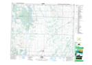
Maps showing Muskeg Lake 102F, 46-7-W3, Saskatchewan
Muskeg Lake 102F is a Indian Reserve located in 46-7-W3, Saskatchewan.
- Latitude: 53° 0' 26'' North (decimal: 53.0072289)
- Longitude: 106° 53' 11'' West (decimal: -106.8864733)
- Topography Feature Category: Indian Reserve
- Geographical Feature: Indian Reserve - Réserve indienne
- Canadian Province/Territory: Saskatchewan
- Location: 46-7-W3
- Atlas of Canada Locator Map: Muskeg Lake 102F
- GPS Coordinate Locator Map: Muskeg Lake 102F Lat/Long