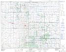
Maps showing Muskowekwan 85-13, 27-16-W2, Saskatchewan
Muskowekwan 85-13 is a Indian Reserve located in 27-16-W2, Saskatchewan.
- Latitude: 51° 19' 56'' North (decimal: 51.3322135)
- Longitude: 104° 14' 51'' West (decimal: -104.2473636)
- Topography Feature Category: Indian Reserve
- Geographical Feature: Indian Reserve - Réserve indienne
- Canadian Province/Territory: Saskatchewan
- Location: 27-16-W2
- Atlas of Canada Locator Map: Muskowekwan 85-13
- GPS Coordinate Locator Map: Muskowekwan 85-13 Lat/Long