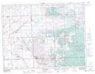
Maps showing Ocean Man 69H, 34-10-7-W2, Saskatchewan
Ocean Man 69H is a Indian Reserve located in 34-10-7-W2, Saskatchewan.
- Latitude: 49° 51' 28'' North (decimal: 49.8578751)
- Longitude: 102° 52' 22'' West (decimal: -102.8726847)
- Topography Feature Category: Indian Reserve
- Geographical Feature: Indian Reserve - Réserve indienne
- Canadian Province/Territory: Saskatchewan
- Location: 34-10-7-W2
- Atlas of Canada Locator Map: Ocean Man 69H
- GPS Coordinate Locator Map: Ocean Man 69H Lat/Long