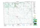
Maps showing Ochapowace 71-20, 16,17-1-W2, Saskatchewan
Ochapowace 71-20 is a Indian Reserve located in 16,17-1-W2, Saskatchewan.
- Latitude: 50° 23' 57'' North (decimal: 50.3991053)
- Longitude: 102° 1' 21'' West (decimal: -102.0226254)
- Topography Feature Category: Indian Reserve
- Geographical Feature: Indian Reserve - Réserve indienne
- Canadian Province/Territory: Saskatchewan
- Location: 16,17-1-W2
- Atlas of Canada Locator Map: Ochapowace 71-20
- GPS Coordinate Locator Map: Ochapowace 71-20 Lat/Long