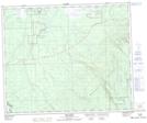
Maps showing Red Earth 29, 51,52-6,7-W2, Saskatchewan
Red Earth 29 is a Indian Reserve located in 51,52-6,7-W2, Saskatchewan.
- Latitude: 53° 26' 28'' North (decimal: 53.4412295)
- Longitude: 102° 52' 23'' West (decimal: -102.8731170)
- Topography Feature Category: Indian Reserve
- Geographical Feature: Indian Reserve - Réserve indienne
- Canadian Province/Territory: Saskatchewan
- Location: 51,52-6,7-W2
- Atlas of Canada Locator Map: Red Earth 29
- GPS Coordinate Locator Map: Red Earth 29 Lat/Long
Red Earth 29 NTS Map Sheets