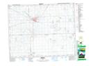
Maps showing Sakimay 74-4, 16,17,20-22-5-W2, Saskatchewan
Sakimay 74-4 is a Indian Reserve located in 16,17,20-22-5-W2, Saskatchewan.
- Latitude: 50° 53' 42'' North (decimal: 50.8950168)
- Longitude: 102° 39' 48'' West (decimal: -102.6632678)
- Topography Feature Category: Indian Reserve
- Geographical Feature: Indian Reserve - Réserve indienne
- Canadian Province/Territory: Saskatchewan
- Location: 16,17,20-22-5-W2
- Atlas of Canada Locator Map: Sakimay 74-4
- GPS Coordinate Locator Map: Sakimay 74-4 Lat/Long