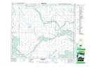
Maps showing Sturgeon Lake 101A, 10,15-51-3-W3, Saskatchewan
Sturgeon Lake 101A is a Indian Reserve located in 10,15-51-3-W3, Saskatchewan.
- Latitude: 53° 24' 50'' North (decimal: 53.4139378)
- Longitude: 106° 21' 32'' West (decimal: -106.3588685)
- Topography Feature Category: Indian Reserve
- Geographical Feature: Indian Reserve - Réserve indienne
- Canadian Province/Territory: Saskatchewan
- Location: 10,15-51-3-W3
- Atlas of Canada Locator Map: Sturgeon Lake 101A
- GPS Coordinate Locator Map: Sturgeon Lake 101A Lat/Long
Sturgeon Lake 101A NTS Map Sheets