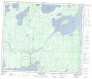
Maps showing Sturgeon Weir 184F, 14,15,22,23,26,27-61-30-W2, Saskatchewan
Sturgeon Weir 184F is a Indian Reserve located in 14,15,22,23,26,27-61-30-W2, Saskatchewan.
- Latitude: 54° 17' 28'' North (decimal: 54.2912394)
- Longitude: 101° 51' 19'' West (decimal: -101.8552876)
- Topography Feature Category: Indian Reserve
- Geographical Feature: Indian Reserve - Réserve indienne
- Canadian Province/Territory: Saskatchewan
- Location: 14,15,22,23,26,27-61-30-W2
- Atlas of Canada Locator Map: Sturgeon Weir 184F
- GPS Coordinate Locator Map: Sturgeon Weir 184F Lat/Long
Sturgeon Weir 184F NTS Map Sheets