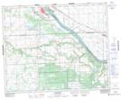
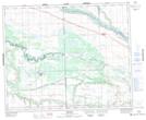
Maps showing Sweetgrass 113-P2, 43-16-W3, Saskatchewan
Sweetgrass 113-P2 is a Indian Reserve located in 43-16-W3, Saskatchewan.
- Latitude: 52° 51' 14'' North (decimal: 52.8538728)
- Longitude: 108° 38' 18'' West (decimal: -108.6382434)
- Topography Feature Category: Indian Reserve
- Geographical Feature: Indian Reserve - Réserve indienne
- Canadian Province/Territory: Saskatchewan
- Location: 43-16-W3
- Atlas of Canada Locator Map: Sweetgrass 113-P2
- GPS Coordinate Locator Map: Sweetgrass 113-P2 Lat/Long
Sweetgrass 113-P2 NTS Map Sheets