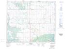
Maps showing Wahpeton 94A, 33,34-49,50-27-W2, Saskatchewan
Wahpeton 94A is a Indian Reserve located in 33,34-49,50-27-W2, Saskatchewan.
- Latitude: 53° 16' 25'' North (decimal: 53.2735694)
- Longitude: 105° 53' 00'' West (decimal: -105.8833332)
- Topography Feature Category: Indian Reserve
- Geographical Feature: Indian Reserve - Réserve indienne
- Canadian Province/Territory: Saskatchewan
- Location: 33,34-49,50-27-W2
- Atlas of Canada Locator Map: Wahpeton 94A
- GPS Coordinate Locator Map: Wahpeton 94A Lat/Long
Wahpeton 94A NTS Map Sheets