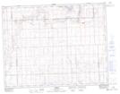
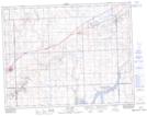
Maps showing Duncairn Reservoir Bird Sanctuary, Saskatchewan
Duncairn Reservoir Bird Sanctuary is a Conservation area located in Saskatchewan and has an elevation of 826 meters.
- Latitude: 50° 1' North (decimal: 50.0167001)
- Longitude: 108° 9' West (decimal: -108.1506911)
- Topography Feature Category: Conservation area
- Geographical Feature: Migratory Bird Sanctuary
- Canadian Province/Territory: Saskatchewan
- Elevation: 826 meters
- Atlas of Canada Locator Map: Duncairn Reservoir Bird Sanctuary
- GPS Coordinate Locator Map: Duncairn Reservoir Bird Sanctuary Lat/Long
Duncairn Reservoir Bird Sanctuary NTS Map Sheets