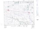
Maps showing Kahkewistahaw 72D, Saskatchewan
Kahkewistahaw 72D is a Indian Reserve located in Saskatchewan.
- Latitude: 50° 27' 58'' North (decimal: 50.4661110)
- Longitude: 102° 33' 1'' West (decimal: -102.5502778)
- Topography Feature Category: Indian Reserve
- Geographical Feature: Indian Reserve - Réserve indienne
- Canadian Province/Territory: Saskatchewan
- Atlas of Canada Locator Map: Kahkewistahaw 72D
- GPS Coordinate Locator Map: Kahkewistahaw 72D Lat/Long