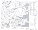
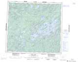
Maps showing Cree Lake 192G, Saskatchewan
Cree Lake 192G is a Indian Reserve located in Saskatchewan.
- Latitude: 57° 23' 5'' North (decimal: 57.3848491)
- Longitude: 107° 3' 52'' West (decimal: -107.0643707)
- Topography Feature Category: Indian Reserve
- Geographical Feature: Indian Reserve - Réserve indienne
- Canadian Province/Territory: Saskatchewan
- Atlas of Canada Locator Map: Cree Lake 192G
- GPS Coordinate Locator Map: Cree Lake 192G Lat/Long
Cree Lake 192G NTS Map Sheets