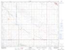
Maps showing Piapot 75E, Saskatchewan
Piapot 75E is a Indian Reserve located in Saskatchewan.
- Latitude: 49° 50' 51'' North (decimal: 49.8474194)
- Longitude: 104° 50' 16'' West (decimal: -104.8378979)
- Topography Feature Category: Indian Reserve
- Geographical Feature: Indian Reserve - Réserve indienne
- Canadian Province/Territory: Saskatchewan
- Atlas of Canada Locator Map: Piapot 75E
- GPS Coordinate Locator Map: Piapot 75E Lat/Long
Piapot 75E NTS Map Sheets