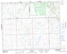
Maps showing Sweetgrass 113-S6, Saskatchewan
Sweetgrass 113-S6 is a Indian Reserve located in Saskatchewan.
- Latitude: 52° 40' 34'' North (decimal: 52.6760138)
- Longitude: 108° 45' 9'' West (decimal: -108.7526242)
- Topography Feature Category: Indian Reserve
- Geographical Feature: Indian Reserve - Réserve indienne
- Canadian Province/Territory: Saskatchewan
- Atlas of Canada Locator Map: Sweetgrass 113-S6
- GPS Coordinate Locator Map: Sweetgrass 113-S6 Lat/Long
Sweetgrass 113-S6 NTS Map Sheets