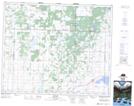
Maps showing Moosomin 112P, Saskatchewan
Moosomin 112P is a Indian Reserve located in Saskatchewan.
- Latitude: 52° 55' 25'' North (decimal: 52.9236519)
- Longitude: 107° 17' 10'' West (decimal: -107.2860728)
- Topography Feature Category: Indian Reserve
- Geographical Feature: Indian Reserve - Réserve indienne
- Canadian Province/Territory: Saskatchewan
- Atlas of Canada Locator Map: Moosomin 112P
- GPS Coordinate Locator Map: Moosomin 112P Lat/Long