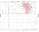
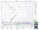
Maps showing Piapot First Nation 75T, Saskatchewan
Piapot First Nation 75T is a Indian Reserve located in Saskatchewan.
- Latitude: 50° 45' 42'' North (decimal: 50.7617348)
- Longitude: 104° 21' 21'' West (decimal: -104.3557018)
- Topography Feature Category: Indian Reserve
- Geographical Feature: Indian Reserve - Réserve indienne
- Canadian Province/Territory: Saskatchewan
- Atlas of Canada Locator Map: Piapot First Nation 75T
- GPS Coordinate Locator Map: Piapot First Nation 75T Lat/Long
Piapot First Nation 75T NTS Map Sheets