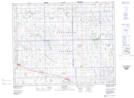
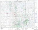
Maps showing Muskowekwan 85-40, Saskatchewan
Muskowekwan 85-40 is a Indian Reserve located in Saskatchewan.
- Latitude: 51° 16' 46'' North (decimal: 51.2794777)
- Longitude: 104° 0' 7'' West (decimal: -104.0020568)
- Topography Feature Category: Indian Reserve
- Geographical Feature: Indian Reserve - Réserve indienne
- Canadian Province/Territory: Saskatchewan
- Atlas of Canada Locator Map: Muskowekwan 85-40
- GPS Coordinate Locator Map: Muskowekwan 85-40 Lat/Long
Muskowekwan 85-40 NTS Map Sheets