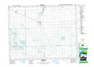
Maps showing Carry The Kettle Nakoda First Nation 76-10, Saskatchewan
Carry The Kettle Nakoda First Nation 76-10 is a Indian Reserve located in Saskatchewan.
- Latitude: 50° 27' 58'' North (decimal: 50.4661402)
- Longitude: 103° 12' 53'' West (decimal: -103.2146862)
- Topography Feature Category: Indian Reserve
- Geographical Feature: Indian Reserve - Réserve indienne
- Canadian Province/Territory: Saskatchewan
- Atlas of Canada Locator Map: Carry The Kettle Nakoda First Nation 76-10
- GPS Coordinate Locator Map: Carry The Kettle Nakoda First Nation 76-10 Lat/Long