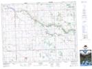
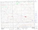
Maps showing Ochapowace 71-100, Saskatchewan
Ochapowace 71-100 is a Indian Reserve located in Saskatchewan.
- Latitude: 50° 14' 0'' North (decimal: 50.2333854)
- Longitude: 102° 29' 44'' West (decimal: -102.4954184)
- Topography Feature Category: Indian Reserve
- Geographical Feature: Indian Reserve - Réserve indienne
- Canadian Province/Territory: Saskatchewan
- Atlas of Canada Locator Map: Ochapowace 71-100
- GPS Coordinate Locator Map: Ochapowace 71-100 Lat/Long
Ochapowace 71-100 NTS Map Sheets