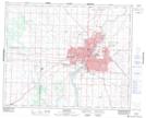
Maps showing Sounding Sky, Saskatchewan
Sounding Sky is a Indian Reserve located in Saskatchewan.
- Latitude: 52° 7' 33'' North (decimal: 52.1258792)
- Longitude: 106° 41' 40'' West (decimal: -106.6944431)
- Topography Feature Category: Indian Reserve
- Geographical Feature: Indian Reserve - Réserve indienne
- Canadian Province/Territory: Saskatchewan
- Atlas of Canada Locator Map: Sounding Sky
- GPS Coordinate Locator Map: Sounding Sky Lat/Long
Sounding Sky NTS Map Sheets