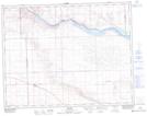
Maps showing Carry The Kettle Nakoda First Nation 76-33, Saskatchewan
Carry The Kettle Nakoda First Nation 76-33 is a Indian Reserve located in Saskatchewan.
- Latitude: 50° 52' 25'' North (decimal: 50.8736067)
- Longitude: 108° 35' 1'' West (decimal: -108.5836278)
- Topography Feature Category: Indian Reserve
- Geographical Feature: Indian Reserve - Réserve indienne
- Canadian Province/Territory: Saskatchewan
- Atlas of Canada Locator Map: Carry The Kettle Nakoda First Nation 76-33
- GPS Coordinate Locator Map: Carry The Kettle Nakoda First Nation 76-33 Lat/Long