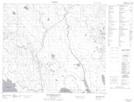
Maps showing Mckay 209, Saskatchewan
Mckay 209 is a Indian Reserve located in Saskatchewan.
- Latitude: 54° 44' 30'' North (decimal: 54.7416992)
- Longitude: 105° 37' 16'' West (decimal: -105.6212176)
- Topography Feature Category: Indian Reserve
- Geographical Feature: Indian Reserve - Réserve indienne
- Canadian Province/Territory: Saskatchewan
- Atlas of Canada Locator Map: Mckay 209
- GPS Coordinate Locator Map: Mckay 209 Lat/Long
Mckay 209 NTS Map Sheets