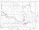
Maps showing Woodpecker Island, 18-10-16-W4, Alberta
Woodpecker Island is a Island located in 18-10-16-W4, Alberta and has an elevation of 769 meters.
- Latitude: 49° 49' 31'' North (decimal: 49.8252777)
- Longitude: 112° 9' 36'' West (decimal: -112.1599999)
- Topography Feature Category: Island
- Geographical Feature: Island
- Canadian Province/Territory: Alberta
- Elevation: 769 meters
- Location: 18-10-16-W4
- Atlas of Canada Locator Map: Woodpecker Island
- GPS Coordinate Locator Map: Woodpecker Island Lat/Long