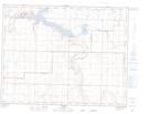
Maps showing Woolf Coulee, 14-21,22-W4, Alberta
Woolf Coulee is a Valley located in 14-21,22-W4, Alberta and has an elevation of 945 meters.
- Latitude: 50° 11' 23'' North (decimal: 50.1897221)
- Longitude: 112° 52' 49'' West (decimal: -112.8802777)
- Topography Feature Category: Valley
- Geographical Feature: Coulee
- Canadian Province/Territory: Alberta
- Elevation: 945 meters
- Location: 14-21,22-W4
- Atlas of Canada Locator Map: Woolf Coulee
- GPS Coordinate Locator Map: Woolf Coulee Lat/Long