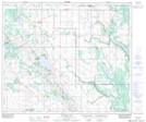
Maps showing Worry Lake, 30-60-10-W4, Alberta
Worry Lake is a Lake located in 30-60-10-W4, Alberta and has an elevation of 667 meters.
- Latitude: 54° 13' 7'' North (decimal: 54.2186111)
- Longitude: 111° 28' 50'' West (decimal: -111.4805555)
- Topography Feature Category: Lake
- Geographical Feature: Lake
- Canadian Province/Territory: Alberta
- Elevation: 667 meters
- Location: 30-60-10-W4
- Atlas of Canada Locator Map: Worry Lake
- GPS Coordinate Locator Map: Worry Lake Lat/Long
Worry Lake NTS Map Sheets