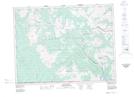
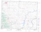
Maps showing Yarrow Creek, 15-4-29-W4, Alberta
Yarrow Creek is a River located in 15-4-29-W4, Alberta and has an elevation of 1425 meters.
- Latitude: 49° 17' 57'' North (decimal: 49.2991666)
- Longitude: 113° 48' 56'' West (decimal: -113.8155555)
- Topography Feature Category: River
- Geographical Feature: Creek
- Canadian Province/Territory: Alberta
- Elevation: 1425 meters
- Location: 15-4-29-W4
- Atlas of Canada Locator Map: Yarrow Creek
- GPS Coordinate Locator Map: Yarrow Creek Lat/Long
Yarrow Creek NTS Map Sheets