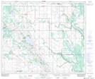
Maps showing Yelling Creek, 12-60-8-W4, Alberta
Yelling Creek is a River located in 12-60-8-W4, Alberta and has an elevation of 629 meters.
- Latitude: 54° 10' 19'' North (decimal: 54.1719444)
- Longitude: 111° 3' 41'' West (decimal: -111.0613889)
- Topography Feature Category: River
- Geographical Feature: Creek
- Canadian Province/Territory: Alberta
- Elevation: 629 meters
- Location: 12-60-8-W4
- Atlas of Canada Locator Map: Yelling Creek
- GPS Coordinate Locator Map: Yelling Creek Lat/Long
Yelling Creek NTS Map Sheets