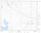
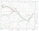
Maps showing Young Creek, 35-38-13-W4, Alberta
Young Creek is a River located in 35-38-13-W4, Alberta and has an elevation of 824 meters.
- Latitude: 52° 18' 14'' North (decimal: 52.3038888)
- Longitude: 111° 45' 9'' West (decimal: -111.7524999)
- Topography Feature Category: River
- Geographical Feature: Creek
- Canadian Province/Territory: Alberta
- Elevation: 824 meters
- Location: 35-38-13-W4
- Atlas of Canada Locator Map: Young Creek
- GPS Coordinate Locator Map: Young Creek Lat/Long
Young Creek NTS Map Sheets