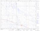
Maps showing Youngstown, 33-29-9-W4, Alberta
Youngstown is a Village located in 33-29-9-W4, Alberta and has an elevation of 776 meters.
- Latitude: 51° 31' 44'' North (decimal: 51.5288888)
- Longitude: 111° 12' 37'' West (decimal: -111.2102777)
- Topography Feature Category: Village
- Geographical Feature: Village
- Canadian Province/Territory: Alberta
- Elevation: 776 meters
- Location: 33-29-9-W4
- Atlas of Canada Locator Map: Youngstown
- GPS Coordinate Locator Map: Youngstown Lat/Long