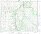
Maps showing Wilkins Lake, 42-8-W4, Alberta
Wilkins Lake is a Lake located in 42-8-W4, Alberta and has an elevation of 685 meters.
- Latitude: 52° 36' 9'' North (decimal: 52.6024999)
- Longitude: 111° 5' 12'' West (decimal: -111.0866666)
- Topography Feature Category: Lake
- Geographical Feature: Lake
- Canadian Province/Territory: Alberta
- Elevation: 685 meters
- Location: 42-8-W4
- Atlas of Canada Locator Map: Wilkins Lake
- GPS Coordinate Locator Map: Wilkins Lake Lat/Long
Wilkins Lake NTS Map Sheets