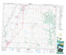
Maps showing Kenning Slough, 36-28-W4, Alberta
Kenning Slough is a Lake located in 36-28-W4, Alberta and has an elevation of 900 meters.
- Latitude: 52° 7' 38'' North (decimal: 52.1272222)
- Longitude: 113° 56' 2'' West (decimal: -113.9338888)
- Topography Feature Category: Lake
- Geographical Feature: Slough
- Canadian Province/Territory: Alberta
- Elevation: 900 meters
- Location: 36-28-W4
- Atlas of Canada Locator Map: Kenning Slough
- GPS Coordinate Locator Map: Kenning Slough Lat/Long