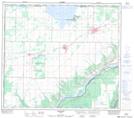
Maps showing Peace River Crossing Indian Reserve 151A, 9-82-25 W5, Alberta
Peace River Crossing Indian Reserve 151A is a Indian Reserve located in 9-82-25 W5, Alberta.
- Latitude: 56° 5' 45'' North (decimal: 56.0958000)
- Longitude: 117° 51' 0'' West (decimal: -117.8500000)
- Topography Feature Category: Indian Reserve
- Geographical Feature: Indian Reserve
- Canadian Province/Territory: Alberta
- Location: 9-82-25 W5
- GPS Coordinate Locator Map: Peace River Crossing Indian Reserve 151A Lat/Long
Peace River Crossing Indian Reserve 151A NTS Map Sheets