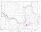
Maps showing Taber, 5-10-16-W4, Alberta
Taber is a Town located in 5-10-16-W4, Alberta and has an elevation of 810 meters.
- Latitude: 49° 47' 5'' North (decimal: 49.7847500)
- Longitude: 112° 9' 3'' West (decimal: -112.1509719)
- Topography Feature Category: Town
- Geographical Feature: Town
- Canadian Province/Territory: Alberta
- Elevation: 810 meters
- Location: 5-10-16-W4
- Atlas of Canada Locator Map: Taber
- GPS Coordinate Locator Map: Taber Lat/Long