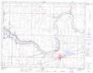
Maps showing Taber Lake, 10-16-W4, Alberta
Taber Lake is a Lake located in 10-16-W4, Alberta and has an elevation of 793 meters.
- Latitude: 49° 48' 12'' North (decimal: 49.8033333)
- Longitude: 112° 5' 33'' West (decimal: -112.0924999)
- Topography Feature Category: Lake
- Geographical Feature: Lake
- Canadian Province/Territory: Alberta
- Elevation: 793 meters
- Location: 10-16-W4
- Atlas of Canada Locator Map: Taber Lake
- GPS Coordinate Locator Map: Taber Lake Lat/Long