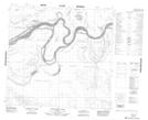
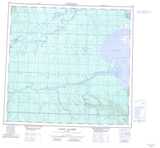
Maps showing Taerum Lake, 110-24-W4, Alberta
Taerum Lake is a Lake located in 110-24-W4, Alberta and has an elevation of 243 meters.
- Latitude: 58° 35' 5'' North (decimal: 58.5847779)
- Longitude: 113° 52' 19'' West (decimal: -113.8719170)
- Topography Feature Category: Lake
- Geographical Feature: Lake
- Canadian Province/Territory: Alberta
- Elevation: 243 meters
- Location: 110-24-W4
- Atlas of Canada Locator Map: Taerum Lake
- GPS Coordinate Locator Map: Taerum Lake Lat/Long
Taerum Lake NTS Map Sheets