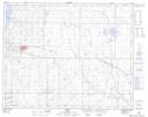
Maps showing Taplow, 15-30-13-W4, Alberta
Taplow is a Unincorporated area located in 15-30-13-W4, Alberta and has an elevation of 831 meters.
- Latitude: 51° 33' 50'' North (decimal: 51.5638888)
- Longitude: 111° 44' 38'' West (decimal: -111.7438889)
- Topography Feature Category: Unincorporated area
- Geographical Feature: Locality
- Canadian Province/Territory: Alberta
- Elevation: 831 meters
- Location: 15-30-13-W4
- Atlas of Canada Locator Map: Taplow
- GPS Coordinate Locator Map: Taplow Lat/Long