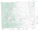
Maps showing Byron Creek Falls, 9-7-3-W5M, Alberta
Byron Creek Falls is a Falls located in 9-7-3-W5M, Alberta.
- Latitude: 49° 32' 47'' North (decimal: 49.5463889)
- Longitude: 114° 21' 6'' West (decimal: -114.3516667)
- Topography Feature Category: Falls
- Geographical Feature: Falls
- Canadian Province/Territory: Alberta
- Location: 9-7-3-W5M
- Atlas of Canada Locator Map: Byron Creek Falls
- GPS Coordinate Locator Map: Byron Creek Falls Lat/Long