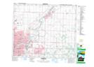
Maps showing Dunbar, 14-53-23-W4M, Alberta
Dunbar is a Unincorporated area located in 14-53-23-W4M, Alberta.
- Latitude: 53° 34' 44'' North (decimal: 53.5788889)
- Longitude: 113° 17' 9'' West (decimal: -113.2858333)
- Topography Feature Category: Unincorporated area
- Geographical Feature: Railway Point
- Canadian Province/Territory: Alberta
- Location: 14-53-23-W4M
- Atlas of Canada Locator Map: Dunbar
- GPS Coordinate Locator Map: Dunbar Lat/Long