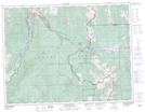
Maps showing Star Creek Falls, 6-8-4-W5M, Alberta
Star Creek Falls is a Falls located in 6-8-4-W5M, Alberta.
- Latitude: 49° 37' 34'' North (decimal: 49.6261111)
- Longitude: 114° 32' 22'' West (decimal: -114.5394444)
- Topography Feature Category: Falls
- Geographical Feature: Falls
- Canadian Province/Territory: Alberta
- Location: 6-8-4-W5M
- Atlas of Canada Locator Map: Star Creek Falls
- GPS Coordinate Locator Map: Star Creek Falls Lat/Long