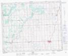
Maps showing Red Lodge Provincial Park, 34-2-W5, Alberta
Red Lodge Provincial Park is a Conservation area located in 34-2-W5, Alberta and has an elevation of 954 meters.
- Latitude: 51° 56' 40'' North (decimal: 51.9444444)
- Longitude: 114° 14' 39'' West (decimal: -114.2441667)
- Topography Feature Category: Conservation area
- Geographical Feature: Provincial Park
- Canadian Province/Territory: Alberta
- Elevation: 954 meters
- Location: 34-2-W5
- Atlas of Canada Locator Map: Red Lodge Provincial Park
- GPS Coordinate Locator Map: Red Lodge Provincial Park Lat/Long